
file:Pakistan tehsils.svg

Size of this PNG preview of this SVG file: 512 × 279 pixels. Duusra resolutions: 320 × 174 pixels | 640 × 349 pixels | 1,024 × 558 pixels | 1,280 × 698 pixels | 2,560 × 1,395 pixels.
Original file (SVG file, naam kare ke khatir 512 × 279 pixels, file size: 940 KB)
Sanchhipt me
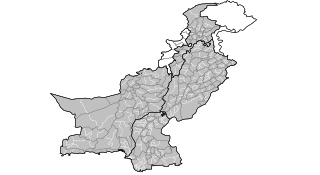
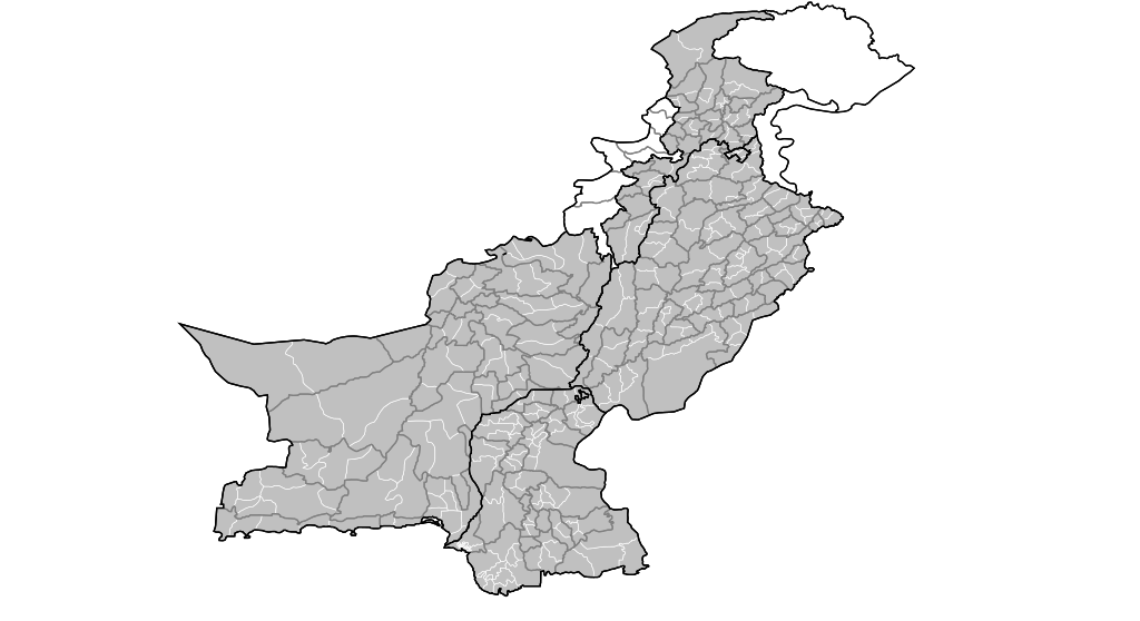
| Baare me | Map of the tehsils of Pakistan. Map includes the disputed areas. Created by Rarelibra 20:47, 31 October 2007 (UTC) for public domain use, using MapInfo Professional v8.5 and various mapping resources. |
| Taarik | 31 Actobar 2007 (original upload date) |
| Source | No machine-readable source provided. Own work assumed (based on copyright claims). |
| Likhe waala | No machine-readable author provided. Rarelibra assumed (based on copyright claims). |
Licence ke baare me
| I, the copyright holder of this work, release this work into the public domain. This applies worldwide. In some countries this may not be legally possible; if so: I grant anyone the right to use this work for any purpose, without any conditions, unless such conditions are required by law. |
File ke itihaas
File ke dekhe khatir, jaise uu time dekhe me lagat rahaa, date/time pe click karo.
| Din/Time | Chhota chapa | Lambai aur chaurai | Sadasya | Tiprrin | |
|---|---|---|---|---|---|
| abhi waala | 20:47, 31 Actobar 2007 | | 512 × 279 (940 KB) | Rarelibra | Map of the tehsils of Pakistan. Map includes the disputed areas. Created by ~~~~ for public domain use, using MapInfo Professional v8.5 and various mapping resources. |
File ke kaise kaam me lawa gais hae
Ii file ke koi panna kaam me nai laae hai.
Global file usage
Ii aur duusra wiki ii file ke use kare hai:
- ar.wikipedia.org pe upyog
- ckb.wikipedia.org pe upyog