
file:India Uttarakhand location map.svg

Size of this PNG preview of this SVG file: 722 × 600 pixels. Duusra resolutions: 289 × 240 pixels | 578 × 480 pixels | 925 × 768 pixels | 1,233 × 1,024 pixels | 2,465 × 2,048 pixels | 957 × 795 pixels.
Original file (SVG file, naam kare ke khatir 957 × 795 pixels, file size: 311 KB)
P9328056203
Sanchhipt me
| Baare me |
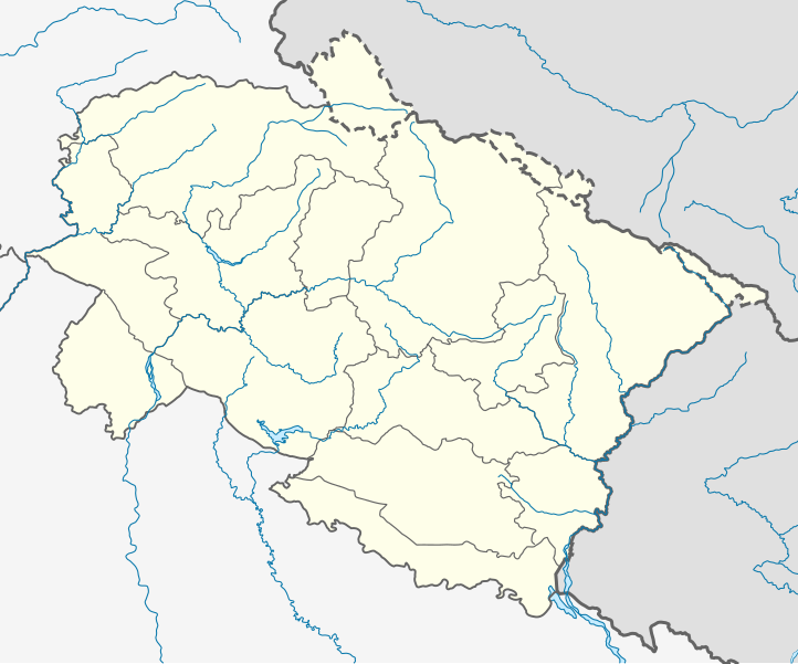
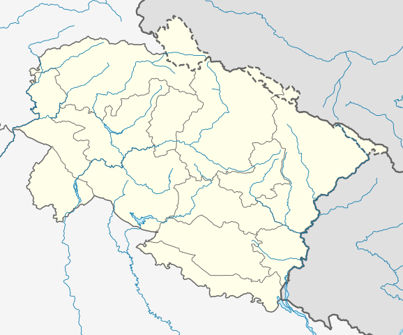
Location map of Uttarakhand Geographic limits of the map:
|
| Taarik | |
| Source | |
| Likhe waala |
|
Licence ke baare me
I, the copyright holder of this work, hereby publish it under the following license:
ii file ke Creative Commons Attribution-Share Alike 3.0 Unported license ke niche licence karaa gais hai.
- You are free:
- share kare ke khaatir – to copy, distribute and transmit the work
- to remix – to adapt the work
- II condition ke niiche:
- attribution – Aap ke thiik credit de ke chaahi, licence pe jorr de ke chaahi, aur badlao ke dekhae ke chaahi. Aap iske koi reasonable manner me kare saktaa hai lekin aise nai ki lage ki licensor aap ke, nai to aap ke kaam ke endorse kre hai
- share alike – Agar aap milaata hai, badaltaa hai, nai to material pe jorrtaa hai, tab aap ke aapan yogdaan ke same or compatible license ke niche baate kare kae chaaahi.
File ke itihaas
File ke dekhe khatir, jaise uu time dekhe me lagat rahaa, date/time pe click karo.
| Din/Time | Chhota chapa | Lambai aur chaurai | Sadasya | Tiprrin | |
|---|---|---|---|---|---|
| abhi waala | 03:00, 23 Mai 2021 | | 957 × 795 (311 KB) | C1MM | Corrected rivers and dist boundaries |
| 04:43, 27 Janwari 2021 |  | 1,245 × 1,122 (161 KB) | C1MM | Changed line weights and regrouped rivers | |
| 04:13, 27 Janwari 2021 |  | 1,245 × 1,122 (167 KB) | C1MM | Increased line weight, district lines difficult to see in previous map | |
| 05:17, 22 Aprel 2020 |  | 1,245 × 1,122 (167 KB) | C1MM | Added rivers | |
| 18:42, 5 Julai 2014 |  | 1,245 × 1,122 (106 KB) | Milenioscuro | lines | |
| 18:22, 5 Julai 2014 |  | 1,245 × 1,122 (106 KB) | Milenioscuro | User created page with UploadWizard |
File ke kaise kaam me lawa gais hae
Ii file ke koi panna kaam me nai laae hai.
Global file usage
Ii aur duusra wiki ii file ke use kare hai:
- azb.wikipedia.org pe upyog
- کالیمات
- مارودا
- جوی (هیندوستان)
- جهولاقات
- جالتولا
- آمالدو (هیندوستان)
- مالاری
- رایدول
- لوچهمان قارهی
- پولام سومدا
- پرم ناقار, یوتاراخاند
- هارسیل
- پیپالکوتی
- قونجی, یوتاراخاند
- قورا پادو
- پانقوت (هیندوستان)
- قانقاریا
- دوالتال
- اوقلا (هیندوستان)
- داکپاتار
- چیتای (هیندوستان)
- ناتواخان
- چانچ (هیندوستان)
- بیرون دوال
- میرتولا
- مهالچاوری
- بنجی ویلیج
- کامالواقانجا
- خاتیاری
- بارچهینا
- باسوکدار
- کوتریساین
- باهادر آباد
- بایرولا
- ban.wikipedia.org pe upyog
- bh.wikipedia.org pe upyog
Ii file ke more global usage kedekho.