Jump to content

file:India Uttar Pradesh location map.svg

Page contents not supported in other languages.
Wikipedia se

Original file (SVG file, naam kare ke khatir 1,006 × 981 pixels, file size: 776 KB)

Ii file Wikimedia Commons se aais hai aur duusra projects me bhi kaam me lawa jaae sake hai. Iske baare me aur jaankari file description page ke niche dekhawa jaae hai.

Sanchhipt me

Baare me
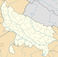
Deutsch: Positionskarte von Uttar Pradesh, Indien

Quadratische Plattkarte, N-S-Streckung 112 %. Geographische Begrenzung der Karte:

  • N: 30.5° N
  • S: 23.8° N
  • W: 77.0° O
  • O: 84.7° O
English: Location map of Uttar Pradesh, India

Equirectangular projection, N/S stretching 112 %. Geographic limits of the map:

  • N: 30.5° N
  • S: 23.8° N
  • W: 77.0° E
  • E: 84.7° E
Taarik
Source

Aapan kaam, using

  • United States National Imagery and Mapping Agency data
Likhe waala NordNordWest
Adhikaar
(Ii file ke fir se kaam me laawa jaae hai)

I have published this file as author NordNordWest under the "CC-BY-SA-3.0-DE" in Wikipedia. This means that free, commercial usage outside of Wikipedia is permitted under the following licence terms:

Please send me a specimen copy or the URL of the website where the file is used.

Please write an email to nnwest[at]web.de if you

  • need my postal address for sending a specimen copy
  • have further questions about the terms of the licence

PS: In case of refusal of the above terms the author reserves the right to take legal action.

w:en:Creative Commons
attribution share alike
This file is licensed under the Creative Commons Attribution-Share Alike 3.0 Germany license.
You are free:
  • share kare ke khaatir – to copy, distribute and transmit the work
  • to remix – to adapt the work
II condition ke niiche:
  • attribution – Aap ke thiik credit de ke chaahi, licence pe jorr de ke chaahi, aur badlao ke dekhae ke chaahi. Aap iske koi reasonable manner me kare saktaa hai lekin aise nai ki lage ki licensor aap ke, nai to aap ke kaam ke endorse kre hai
  • share alike – Agar aap milaata hai, badaltaa hai, nai to material pe jorrtaa hai, tab aap ke aapan yogdaan ke same or compatible license ke niche baate kare kae chaaahi.
Kartenwerkstatt
This map has been made or improved in the German Kartenwerkstatt (Map Lab). You can propose maps to improve as well.

Captions

Add a one-line explanation of what this file represents
Hindi

Items portrayed in this file

depicts English

copyrighted English

inception English

9 Actobar 2012

media type English

image/svg+xml

File ke itihaas

File ke dekhe khatir, jaise uu time dekhe me lagat rahaa, date/time pe click karo.

Din/TimeChhota chapaLambai aur chauraiSadasyaTiprrin
abhi waala06:40, 1 Mai 202306:40, 1 Mai 2023 waala version ke chhota chapa1,006 × 981 (776 KB)C1MMc borders
04:44, 5 Janwari 202204:44, 5 Janwari 2022 waala version ke chhota chapa1,066 × 927 (777 KB)C1MMCorrected rivers and dist boundaries
22:54, 12 Farwari 202122:54, 12 Farwari 2021 waala version ke chhota chapa909 × 886 (262 KB)C1MMAdded Chhattisgarh
00:41, 8 Janwari 202100:41, 8 Janwari 2021 waala version ke chhota chapa909 × 886 (261 KB)C1MMAdded Amethi district
21:29, 22 Aprel 202021:29, 22 Aprel 2020 waala version ke chhota chapa909 × 886 (249 KB)NordNordWestReverted to version as of 19:51, 9 October 2012 (UTC); no need to change colours
21:00, 22 Aprel 202021:00, 22 Aprel 2020 waala version ke chhota chapa909 × 886 (292 KB)C1MMFixed rivers
20:51, 22 Aprel 202020:51, 22 Aprel 2020 waala version ke chhota chapa909 × 886 (290 KB)C1MMFixed colors and made rivers along borders
19:51, 9 Actobar 201219:51, 9 Actobar 2012 waala version ke chhota chapa909 × 886 (249 KB)NordNordWest=={{int:filedesc}}== {{Information |Description= {{de|Positionskarte von Uttar Pradesh, Indien}} Quadratische Plattkarte, N-S-Streckung 112 %. Geographische Begrenzung der Karte: * N: 30.5° N * S: 23.8° N * W: 77....

Niche ke panna kaam me laae hai ii file ke:

Global file usage

Metadata