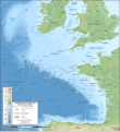
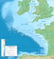
file:Celtic Sea and Bay of Biscay bathymetric map-en.svg
Appearance

Size of this PNG preview of this SVG file: 548 × 599 pixels. Duusra resolutions: 219 × 240 pixels | 439 × 480 pixels | 702 × 768 pixels | 936 × 1,024 pixels | 1,872 × 2,048 pixels | 3,479 × 3,805 pixels.
Original file (SVG file, naam kare ke khatir 3,479 × 3,805 pixels, file size: 4.93 MB)
File ke itihaas
File ke dekhe khatir, jaise uu time dekhe me lagat rahaa, date/time pe click karo.
| Din/Time | Chhota chapa | Lambai aur chaurai | Sadasya | Tiprrin | |
|---|---|---|---|---|---|
| abhi waala | 21:33, 28 Actobar 2019 |  | 3,479 × 3,805 (4.93 MB) | Sting | New map using GEBCO 15 Sec topographic data ; rivers from ECRINS ; added names |
| 14:34, 3 Julai 2014 |  | 1,749 × 1,913 (673 KB) | Erigena | minor tweaks | |
| 12:46, 1 Julai 2014 |  | 1,749 × 1,913 (614 KB) | Erigena | User created page with UploadWizard |
File ke kaise kaam me lawa gais hae
Niche ke panna kaam me laae hai ii file ke:
Global file usage
Ii aur duusra wiki ii file ke use kare hai:
- af.wikipedia.org pe upyog
- azb.wikipedia.org pe upyog
- bg.wikipedia.org pe upyog
- bh.wikipedia.org pe upyog
- bn.wikipedia.org pe upyog
- cs.wikipedia.org pe upyog
- de.wikipedia.org pe upyog
- dtp.wikipedia.org pe upyog
- en.wikipedia.org pe upyog
- en.wikiversity.org pe upyog
- fa.wikipedia.org pe upyog
- fi.wikipedia.org pe upyog
- frr.wikipedia.org pe upyog
- fy.wikipedia.org pe upyog
- hu.wikipedia.org pe upyog
- hy.wikipedia.org pe upyog
- hyw.wikipedia.org pe upyog
- id.wikipedia.org pe upyog
- ja.wikipedia.org pe upyog
- lo.wikipedia.org pe upyog
- lv.wikipedia.org pe upyog
- nl.wikipedia.org pe upyog
- ru.wikipedia.org pe upyog
- sq.wikipedia.org pe upyog
- sr.wikipedia.org pe upyog
- sv.wikipedia.org pe upyog
- tg.wikipedia.org pe upyog
- th.wikipedia.org pe upyog
- tr.wikipedia.org pe upyog
- uk.wikipedia.org pe upyog
- vi.wikipedia.org pe upyog
- vls.wikipedia.org pe upyog
- www.wikidata.org pe upyog
- zh-min-nan.wikipedia.org pe upyog
- zh-yue.wikipedia.org pe upyog
- zh.wikipedia.org pe upyog


