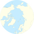
file:Arctic Ocean relief location map.png
Appearance

Ii preview ke size: 600 × 600 pixels Duusra resolutions: 240 × 240 pixels | 480 × 480 pixels | 768 × 768 pixels | 1,181 × 1,181 pixels.
Original file (1,181 × 1,181 pixel, file ke size: 2.19 MB, MIME type: image/png)
File ke itihaas
File ke dekhe khatir, jaise uu time dekhe me lagat rahaa, date/time pe click karo.
| Din/Time | Chhota chapa | Lambai aur chaurai | Sadasya | Tiprrin | |
|---|---|---|---|---|---|
| abhi waala | 08:49, 24 Disambar 2010 |  | 1,181 × 1,181 (2.19 MB) | Uwe Dedering | {{Information |Description={{en|1= Relief location map of the Arctic Ocean. * Projection: Azimuthal equidistant projection. * Area of interest: :* N: 90.0° N :* S: 50.0° N :* W: -180.0° E :* E: 180.0° E * Projection center: :* NS: 90° N :* WE: 0° E |
File ke kaise kaam me lawa gais hae
Niche ke panna kaam me laae hai ii file ke:
Global file usage
Ii aur duusra wiki ii file ke use kare hai:
- ar.wikipedia.org pe upyog
- ast.wikipedia.org pe upyog
- az.wikipedia.org pe upyog
- ban.wikipedia.org pe upyog
- be-tarask.wikipedia.org pe upyog
- ceb.wikipedia.org pe upyog
- ce.wikipedia.org pe upyog
- cs.wikipedia.org pe upyog
- de.wikipedia.org pe upyog
- dsb.wikipedia.org pe upyog
- en.wikipedia.org pe upyog
- Kara Sea
- White Sea
- Ilulissat
- East Siberian Sea
- Kursk submarine disaster
- Lincoln Sea
- ATOW1996
- Jan Mayensfield
- Litke Deep
- Pechora Sea
- Molloy Deep
- Prince Gustaf Adolf Sea
- 83-42
- Module:Location map/data/Arctic/doc
- User:Dino/sandbox
- Greenland Plain
- York Mountains
- Iversenfjellet
- Keilhaufjellet
- Lake North Pole
Ii file ke more global usage kedekho.


