
file:Philippines relief location map (Palawan).svg

Size of this PNG preview of this SVG file: 377 × 377 pixels. Duusra resolutions: 240 × 240 pixels | 480 × 480 pixels | 768 × 768 pixels | 1,024 × 1,024 pixels | 2,048 × 2,048 pixels.
Original file (SVG file, naam kare ke khatir 377 × 377 pixels, file size: 2.21 MB)
.svg)
Sanchhipt me
| Baare me |
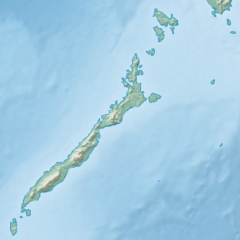
English: Physical location map of the Philippines (Palawan)
Equirectangular projection based on the parallel of 10°43' N
|
| Taarik | |
| Source | File:Philippines location map (square).svg |
| Likhe waala | User:Hellerick |
| Other versions |
This file was derived from: Philippines relief location map (square).svg: .svg) |
.svg)
Licence ke baare me
ii file ke Creative Commons Attribution-Share Alike 3.0 Unported license ke niche licence karaa gais hai.
- You are free:
- share kare ke khaatir – to copy, distribute and transmit the work
- to remix – to adapt the work
- II condition ke niiche:
- attribution – Aap ke thiik credit de ke chaahi, licence pe jorr de ke chaahi, aur badlao ke dekhae ke chaahi. Aap iske koi reasonable manner me kare saktaa hai lekin aise nai ki lage ki licensor aap ke, nai to aap ke kaam ke endorse kre hai
- share alike – Agar aap milaata hai, badaltaa hai, nai to material pe jorrtaa hai, tab aap ke aapan yogdaan ke same or compatible license ke niche baate kare kae chaaahi.
File ke itihaas
File ke dekhe khatir, jaise uu time dekhe me lagat rahaa, date/time pe click karo.
| Din/Time | Chhota chapa | Lambai aur chaurai | Sadasya | Tiprrin | |
|---|---|---|---|---|---|
| abhi waala | 17:23, 26 Actobar 2017 | | 377 × 377 (2.21 MB) | Mliu92 | User created page with UploadWizard |
File ke kaise kaam me lawa gais hae
Ii file ke koi panna kaam me nai laae hai.
Global file usage
Ii aur duusra wiki ii file ke use kare hai:
- ban.wikipedia.org pe upyog
- bcl.wikipedia.org pe upyog
- en.wikipedia.org pe upyog
- Busuanga Island
- Tubbataha Reef
- Calamian Islands
- Puerto Princesa Subterranean River National Park
- Mindoro Strait
- Balabac Island
- Mangarin Bay
- Mount Mantalingajan
- Honda Bay
- Calauit Island
- Rasa Island
- Malampaya Sound
- Delian Island
- Module:Location map/data/Palawan
- Module:Location map/data/Palawan/doc
- Bacungan River
- fa.wikipedia.org pe upyog
- fr.wikipedia.org pe upyog
- id.wikipedia.org pe upyog
- ilo.wikipedia.org pe upyog
- lv.wikipedia.org pe upyog
- ml.wikipedia.org pe upyog
- si.wikipedia.org pe upyog
- uz.wikipedia.org pe upyog
.svg)