Erythraean Sea: ke revisions ke biich ke antar
Content deleted Content added
Created page with "thumb|right|300px|Map showing the Erythraean Sea off the Horn of Africa. Drawn by [[James Rennell, 1799.]] [[Image:Map of the Periplus of the Ery..." |
Luckas-bot (Baat | yogdaan) m r2.7.1) (Robot: Adding ar, br, ca, cy, en, fa, hi, hu, pnb, simple, tr, ur |
||
| Rekha 2: | Rekha 2: | ||
[[Image:Map of the Periplus of the Erythraean Sea.jpg|thumb|500px|Names, routes and locations of the ''Periplus of the Erythraean Sea''.]] |
[[Image:Map of the Periplus of the Erythraean Sea.jpg|thumb|500px|Names, routes and locations of the ''Periplus of the Erythraean Sea''.]] |
||
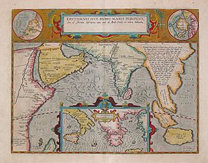
[[Image:PeriplusAncientMap.jpg|thumb|300px|Ancient map (17th century) depicting the locations of the ''Periplus of the Erythraean Sea''.]] |
[[Image:PeriplusAncientMap.jpg|thumb|300px|Ancient map (17th century) depicting the locations of the ''Periplus of the Erythraean Sea''.]] |
||
[[ar:بحر اریترا]] |
|||
[[br:Mor Erythraean]] |
|||
[[ca:Mar d'Eritrea]] |
|||
[[cy:Môr Erythraean]] |
|||
[[en:Erythraean Sea]] |
|||
[[fa:دریای اریتره]] |
|||
[[hi:सागर, इरिट्रिया]] |
|||
[[hu:Erythra-tenger]] |
|||
[[pnb:بحیرہ اریترا]] |
|||
[[simple:Erythraean Sea]] |
|||
[[tr:Erythra Denizi]] |
|||
[[ur:بحیرہ اریترا]] |
|||
17:55, 16 Aprel 2012 ke badlao


