
file:Nepal location map.svg

Size of this PNG preview of this SVG file: 800 × 476 pixels. Duusra resolutions: 320 × 190 pixels | 640 × 381 pixels | 1,024 × 609 pixels | 1,280 × 762 pixels | 2,560 × 1,523 pixels | 1,200 × 714 pixels.
Original file (SVG file, naam kare ke khatir 1,200 × 714 pixels, file size: 296 KB)
Sanchhipt me
| Baare me |
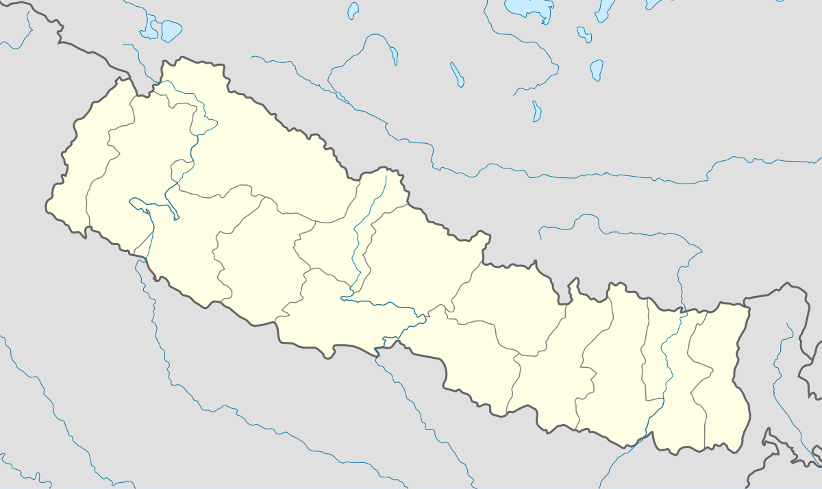
English: Location map of Nepal including the 14 administrative zones (outdated since 2015).
Equirectangular projection. Strechted by 113.0%. Geographic limits of the map: * N: 31.0° N * S: 26.0° N * W: 79.5° E * E: 89.0° EMade with Natural Earth. Free vector and raster map data @ naturalearthdata.com. |
| Taarik | |
| Source | Aapan kaam |
| Likhe waala | Uwe Dedering |
| Other versions |
|


Licence ke baare me
I, the copyright holder of this work, hereby publish it under the following licenses:
ii file ke Creative Commons Attribution-Share Alike 3.0 Unported license ke niche licence karaa gais hai.
- You are free:
- share kare ke khaatir – to copy, distribute and transmit the work
- to remix – to adapt the work
- II condition ke niiche:
- attribution – Aap ke thiik credit de ke chaahi, licence pe jorr de ke chaahi, aur badlao ke dekhae ke chaahi. Aap iske koi reasonable manner me kare saktaa hai lekin aise nai ki lage ki licensor aap ke, nai to aap ke kaam ke endorse kre hai
- share alike – Agar aap milaata hai, badaltaa hai, nai to material pe jorrtaa hai, tab aap ke aapan yogdaan ke same or compatible license ke niche baate kare kae chaaahi.

|
Ijaajat dewa jaae hae ii document ke copy, distribute aur kare ke,under the terms of the GNU Free Documentation License, Version 1.2 or any later version published by the Free Software Foundation; with no Invariant Sections, no Front-Cover Texts, and no Back-Cover Texts. A copy of the license is included in the section entitled GNU Free Documentation License. |
Aap aapan pasand ke licence ke chune saktaa hai.
File ke itihaas
File ke dekhe khatir, jaise uu time dekhe me lagat rahaa, date/time pe click karo.
| Din/Time | Chhota chapa | Lambai aur chaurai | Sadasya | Tiprrin | |
|---|---|---|---|---|---|
| abhi waala | 17:46, 18 Farwari 2010 | | 1,200 × 714 (296 KB) | Uwe Dedering | no disputed countries |
| 13:05, 18 Farwari 2010 |  | 1,200 × 714 (297 KB) | Uwe Dedering | {{Information |Description={{en|1=Location map of Nepal. Equirectangular projection. Strechted by 113.0%. Geographic limits of the map: * N: 31.0° N * S: 26.0° N * W: 79.5° E * E: 89.0° E Made with Natural Earth. Free vector and raster map data |
File ke kaise kaam me lawa gais hae
Global file usage
Ii aur duusra wiki ii file ke use kare hai:
- ar.wikipedia.org pe upyog
- arz.wikipedia.org pe upyog
- ast.wikipedia.org pe upyog
- Everest
- Himalaya
- Makalu
- Kala Patthar
- Ama Dablam
- Cho Oyu
- Gokyo
- Namche Bazaar
- Nuptse
- Glaciar de Khumbu
- Lukla
- Katmandú
- Módulu:Mapa de llocalización/datos/Nepal
- Lhotse
- Dhaulagiri
- Manaslu
- Annapurna
- Módulu:Mapa de llocalización/datos/Nepal/usu
- Aeropuertu Tenzing-Hillary
- Aeropuertu de Bajhang
- Aeropuertu de baxura
- Aeropuertu de Bhadrapur
- Aeropuertu de Bharatpur
- Aeropuertu de Bhojpur
- Aeropuertu de Biratnagar
- azb.wikipedia.org pe upyog
- ba.wikipedia.org pe upyog
- be-tarask.wikipedia.org pe upyog
- bn.wikipedia.org pe upyog
- bpy.wikipedia.org pe upyog
- ceb.wikipedia.org pe upyog
- ce.wikipedia.org pe upyog
- ckb.wikipedia.org pe upyog
- de.wikipedia.org pe upyog
- dty.wikipedia.org pe upyog
- el.wikipedia.org pe upyog
Ii file ke more global usage kedekho.