
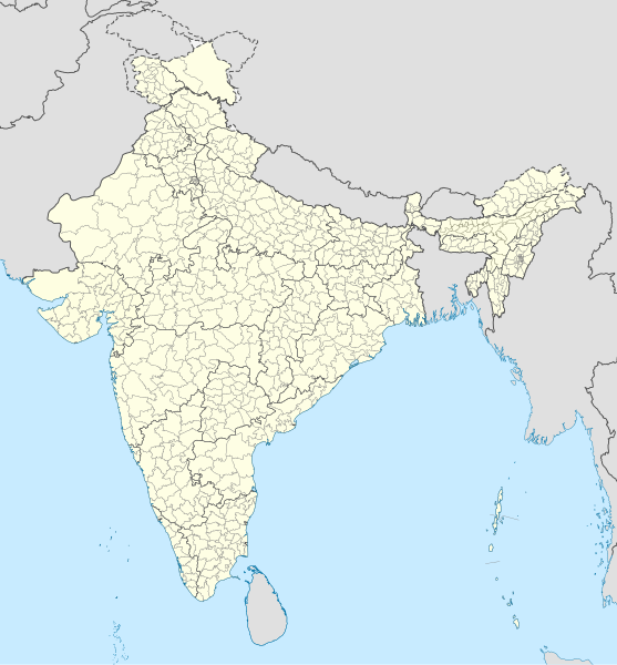
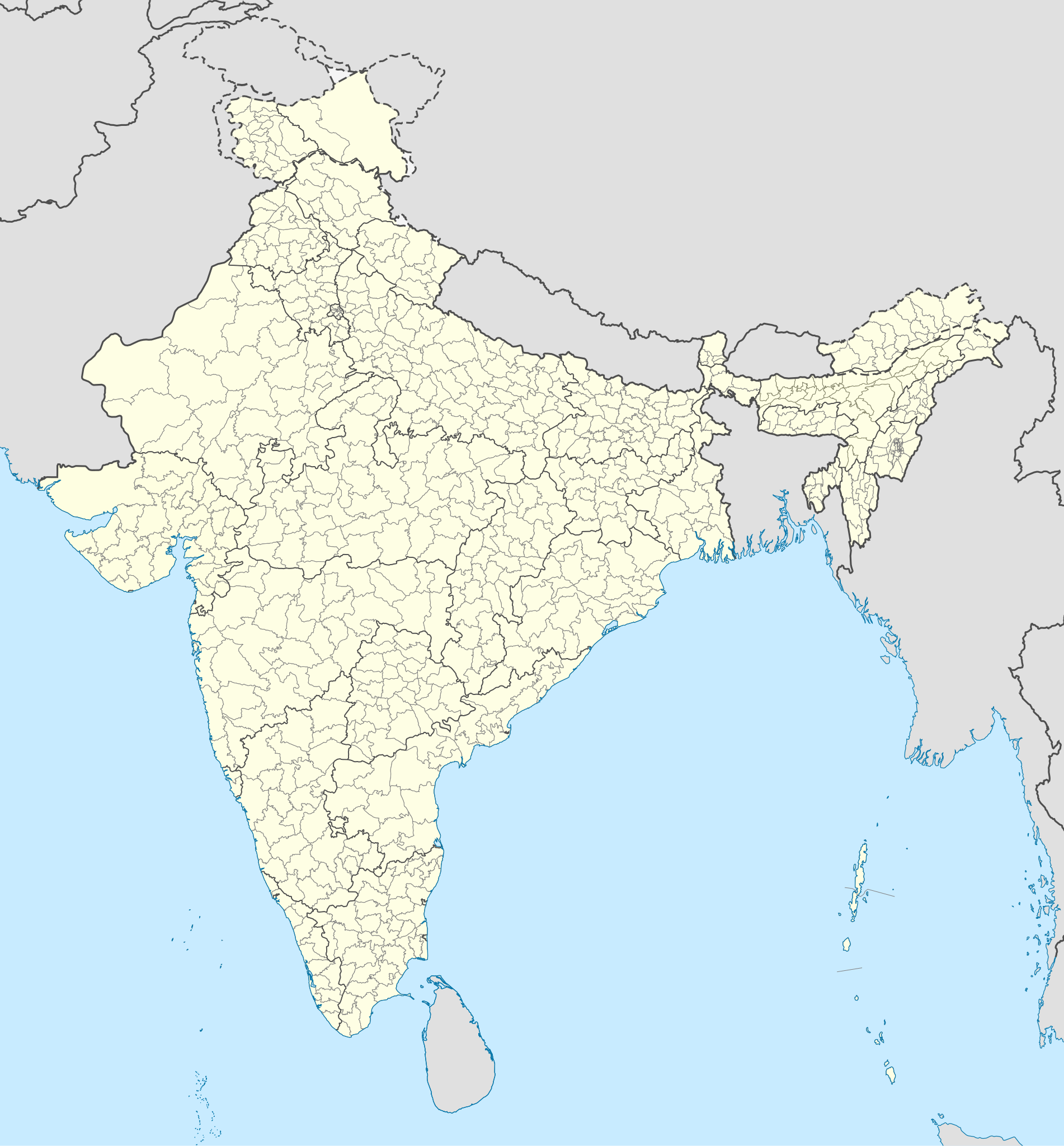
file:India district map (de-facto).svg

Size of this PNG preview of this SVG file: 557 × 600 pixels. Duusra resolutions: 223 × 240 pixels | 446 × 480 pixels | 713 × 768 pixels | 951 × 1,024 pixels | 1,902 × 2,048 pixels | 1,500 × 1,615 pixels.
Original file (SVG file, naam kare ke khatir 1,500 × 1,615 pixels, file size: 3.1 MB)
.svg)
Sanchhipt me
| Baare me |
English: Map of the districts of India. |
| Taarik | |
| Source |
This file was derived from: India Telangana locator map.svg |
| Likhe waala | Superbenjamin |
Licence ke baare me
I, the copyright holder of this work, hereby publish it under the following license:
This file is licensed under the Creative Commons Attribution-Share Alike 4.0 International license.
- You are free:
- share kare ke khaatir – to copy, distribute and transmit the work
- to remix – to adapt the work
- II condition ke niiche:
- attribution – Aap ke thiik credit de ke chaahi, licence pe jorr de ke chaahi, aur badlao ke dekhae ke chaahi. Aap iske koi reasonable manner me kare saktaa hai lekin aise nai ki lage ki licensor aap ke, nai to aap ke kaam ke endorse kre hai
- share alike – Agar aap milaata hai, badaltaa hai, nai to material pe jorrtaa hai, tab aap ke aapan yogdaan ke same or compatible license ke niche baate kare kae chaaahi.
File ke itihaas
File ke dekhe khatir, jaise uu time dekhe me lagat rahaa, date/time pe click karo.
| Din/Time | Chhota chapa | Lambai aur chaurai | Sadasya | Tiprrin | |
|---|---|---|---|---|---|
| abhi waala | 05:18, 2 Mai 2022 | | 1,500 × 1,615 (3.1 MB) | C1MM | Updated to 2022 |
| 16:46, 6 Farwari 2022 |  | 1,643 × 1,856 (1.88 MB) | Milenioscuro | standard colors | |
| 04:34, 22 Saptambar 2021 |  | 1,643 × 1,856 (1.88 MB) | C1MM | Removed duplicate districts | |
| 04:09, 22 Saptambar 2021 |  | 1,643 × 1,856 (1.89 MB) | C1MM | Added far more accurate district boundaries | |
| 20:23, 16 Farwari 2021 |  | 1,643 × 1,856 (2 MB) | C1MM | Added better district boundaries | |
| 06:00, 13 Navambar 2020 |  | 1,643 × 1,856 (1.9 MB) | C1MM | Updated shapefiles, made district boundaries more accurate | |
| 21:00, 25 Julai 2020 |  | 1,643 × 1,856 (1.65 MB) | C1MM | Fixed state and intl border colours | |
| 05:00, 25 Julai 2020 |  | 1,643 × 1,856 (1.64 MB) | C1MM | Reformatted for easier use, updated district map to situation as of July 2020 | |
| 20:34, 15 Maach 2017 |  | 1,643 × 1,856 (800 KB) | Superbenjamin | User created page with UploadWizard |
File ke kaise kaam me lawa gais hae
Niche ke 2 sab panna kaam me laae hai ii file ke:
Global file usage
Ii aur duusra wiki ii file ke use kare hai:
- anp.wikipedia.org pe upyog
- arz.wikipedia.org pe upyog
- bh.wikipedia.org pe upyog
- bn.wikipedia.org pe upyog
- de.wikipedia.org pe upyog
- en.wikipedia.org pe upyog
- es.wikipedia.org pe upyog
- fa.wikipedia.org pe upyog
- fr.wikipedia.org pe upyog
- it.wikipedia.org pe upyog
- ko.wikipedia.org pe upyog
- mai.wikipedia.org pe upyog
- ne.wikipedia.org pe upyog
- nl.wikipedia.org pe upyog
- pnb.wikipedia.org pe upyog
- sat.wikipedia.org pe upyog
- simple.wikipedia.org pe upyog
- ta.wikipedia.org pe upyog
- tcy.wikipedia.org pe upyog
- th.wikipedia.org pe upyog
- tr.wikipedia.org pe upyog
- tum.wikipedia.org pe upyog
- uk.wikipedia.org pe upyog
- ur.wikipedia.org pe upyog
- vi.wikipedia.org pe upyog
- zh.wikipedia.org pe upyog
.svg)