
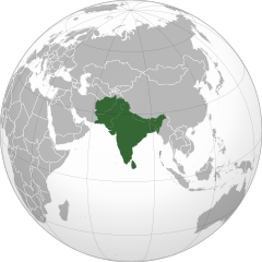
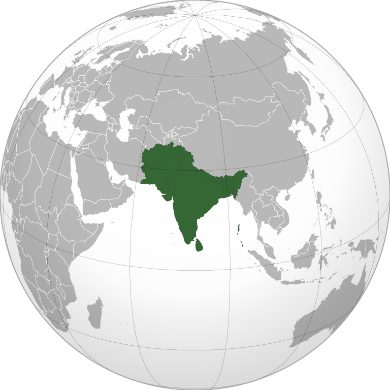
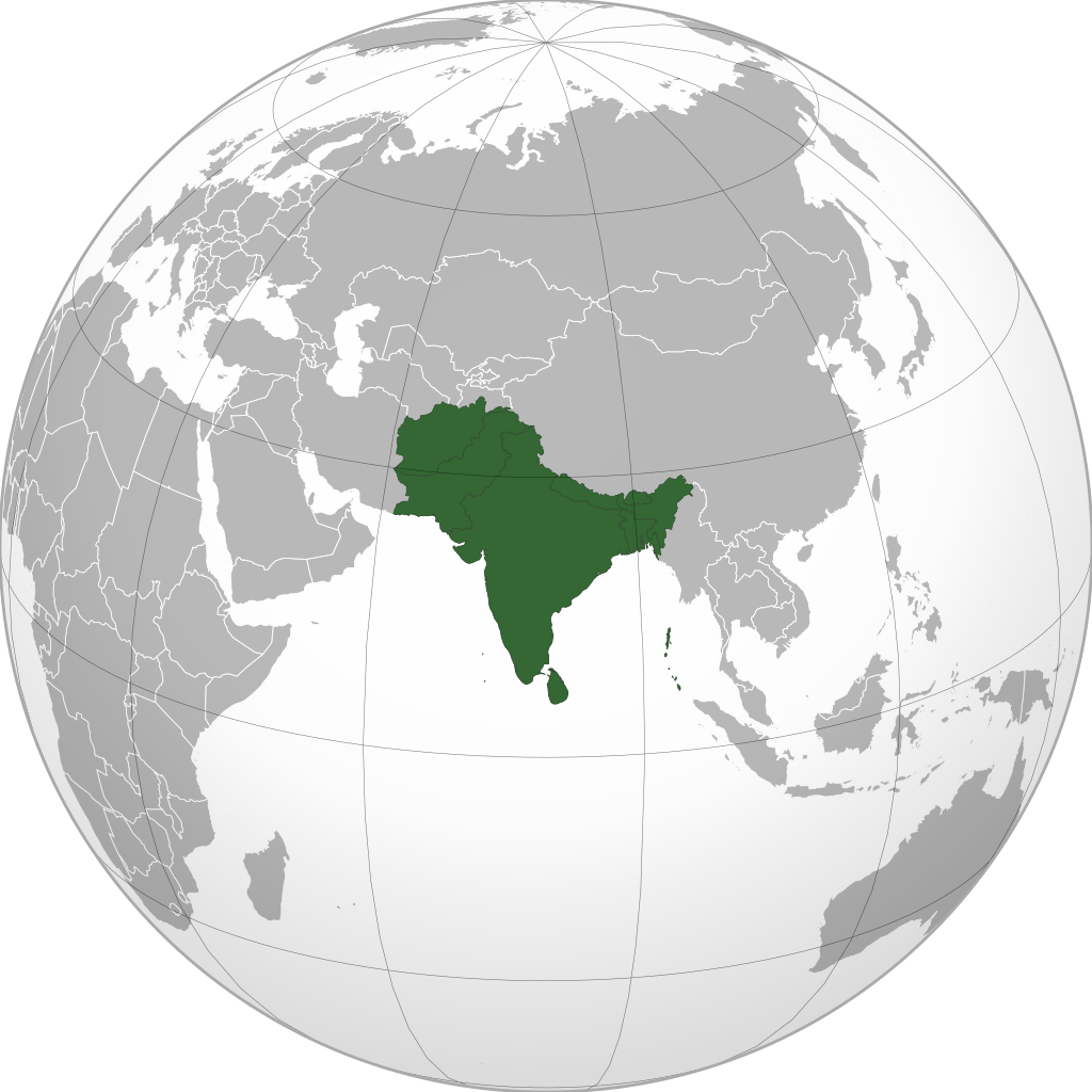
file:South Asia (orthographic projection) without national boundaries.svg

Size of this PNG preview of this SVG file: 550 × 550 pixels. Duusra resolutions: 240 × 240 pixels | 480 × 480 pixels | 768 × 768 pixels | 1,024 × 1,024 pixels | 2,048 × 2,048 pixels.
Original file (SVG file, naam kare ke khatir 550 × 550 pixels, file size: 2.8 MB)
Sanchhipt me
| Baare me |
English: South Asia |
||
| Taarik | (UTC) | ||
| Source | |||
| Likhe waala | user:Serg!o | ||
| Other versions |
.svg) |
||
| SVG genesis |
|
.svg)
.svg)
.svg)
.svg)
.svg)
.svg)
.svg)
.svg)
.svg)
.svg)
.svg)
.svg)
.svg)
.svg)
.svg)
.svg)
.svg)
.svg)
.svg)
.svg)
.svg)
.svg)
.svg)
.svg)
.svg)
.svg)
.svg)
.svg)
.svg)
.svg)
.svg)
.svg)
.svg)
.svg)
.svg)
.svg)
.svg)
.svg)
.svg)
.svg)
.svg)
.svg)
.svg)
.svg)
.svg)
.svg)
.svg)
.svg)
.svg)
.svg)
.svg)
.svg)
.svg)
.svg)
.svg)
.svg)
.svg)
.svg)
.svg)
.svg)
.svg)
.svg)
.svg)
.svg)
.svg)
.svg)
.svg)
.svg)
.svg)
.svg)
.svg)
.svg)
.svg)

.svg)

.svg)

.svg)
.svg)
.svg)
.svg)
.svg)
.svg)
.svg)


.svg)
.svg)
.svg)
.svg)
.svg)
.svg)
.svg)

.svg)
.svg)
.svg)
.svg)
.svg)
.svg)
.svg)
.svg)
.svg)

.svg)
.svg)
.svg)
.svg)
.svg)
.svg)
.svg)
_without_national_boundaries.svg)
.svg)
.svg)
.svg)
.svg)
.svg)
.svg)

.svg)
.svg)
.png)
.svg)
.svg)
.svg)
.svg)

.svg)
.svg)
.svg)
.svg)
.svg)
.svg)
.svg)
.svg)
.svg)
.svg)
.svg)

.svg)
.svg)
.svg)
.svg)
.svg)
.svg)
.svg)
.svg)
.svg)

.svg)
.svg)

.svg)
.svg)
.svg)
.svg)
.svg)
.svg)
.svg)
.svg)
.svg)
.svg)
.svg)
.svg)
.svg)
.svg)
.svg)
.svg)
.svg)
.svg)
.svg)
.svg)
.svg)
.svg)
.svg)
.svg)
.svg)
.svg)
.svg)
_-_Crimea_disputed.svg)
.svg)
.svg)
.svg)
.svg)
.svg)
.svg)
.svg)
.svg)
.svg)
.svg)
.svg)
_political.svg)
.svg)
.svg)
.svg)
.svg)
_-_Crimea_disputed_-_no_borders.svg)
.svg)
.svg)
.svg)
.svg)
.svg)
.svg)
.svg)
.svg)
.svg)
.svg)
.svg)

.svg)
.svg)
.svg)

.png)
.svg)
.svg)
.svg)
.svg)
.svg)
.svg)
.svg)
.svg)
.svg)
.svg)
.svg)
.svg)
.svg)
.svg)
.svg)
.svg)
.svg)
.svg)
.svg)
.svg)
.svg)
.svg)
.svg)
.svg)
.svg)
.svg)
.svg)
.svg)
.svg)
.svg)
.svg)
.svg)
.svg)
.svg)
.png)
.svg)
.svg)
.svg)
_(orthographic_projection).png)
_without_national_boundaries.svg)
Licence ke baare me
I, the copyright holder of this work, hereby publish it under the following licenses:
ii file ke Creative Commons Attribution-Share Alike 3.0 Unported license ke niche licence karaa gais hai.
- You are free:
- share kare ke khaatir – to copy, distribute and transmit the work
- to remix – to adapt the work
- II condition ke niiche:
- attribution – Aap ke thiik credit de ke chaahi, licence pe jorr de ke chaahi, aur badlao ke dekhae ke chaahi. Aap iske koi reasonable manner me kare saktaa hai lekin aise nai ki lage ki licensor aap ke, nai to aap ke kaam ke endorse kre hai
- share alike – Agar aap milaata hai, badaltaa hai, nai to material pe jorrtaa hai, tab aap ke aapan yogdaan ke same or compatible license ke niche baate kare kae chaaahi.

|
Ijaajat dewa jaae hae ii document ke copy, distribute aur kare ke,under the terms of the GNU Free Documentation License, Version 1.2 or any later version published by the Free Software Foundation; with no Invariant Sections, no Front-Cover Texts, and no Back-Cover Texts. A copy of the license is included in the section entitled GNU Free Documentation License. |
|
|
Ijaajat dewa jaae hae ii document ke copy, distribute aur kare ke,under the terms of the GNU Free Documentation License, Version 1.2 or any later version published by the Free Software Foundation; with no Invariant Sections, no Front-Cover Texts, and no Back-Cover Texts. A copy of the license is included in the section entitled GNU Free Documentation License. |
Aap aapan pasand ke licence ke chune saktaa hai.
The map has been created with the Generic Mapping Tools: https://www.generic-mapping-tools.org/ using one or more of these public-domain datasets for the relief:
|
|
|
Ijaajat dewa jaae hae ii document ke copy, distribute aur kare ke,under the terms of the GNU Free Documentation License, Version 1.2 or any later version published by the Free Software Foundation; with no Invariant Sections, no Front-Cover Texts, and no Back-Cover Texts. A copy of the license is included in the section entitled GNU Free Documentation License. |
File ke itihaas
File ke dekhe khatir, jaise uu time dekhe me lagat rahaa, date/time pe click karo.
_without_national_boundaries.svg&dir=prev)
_without_national_boundaries.svg&offset=20200819201055)
_without_national_boundaries.svg&offset=&limit=20)
_without_national_boundaries.svg&offset=&limit=50)
_without_national_boundaries.svg&offset=&limit=100)
_without_national_boundaries.svg&offset=&limit=250)
_without_national_boundaries.svg&offset=&limit=500)
| Din/Time | Chhota chapa | Lambai aur chaurai | Sadasya | Tiprrin | |
|---|---|---|---|---|---|
| abhi waala | 06:10, 12 Navambar 2022 | | 550 × 550 (2.8 MB) | Sourav Bapuli | Added Siachen Glacier as requested by {{u|King Prithviraj II}} |
| 17:56, 1 Janwari 2021 |  | 553 × 553 (216 KB) | Sbb1413 | Converted to Plain SVG. | |
| 17:52, 1 Janwari 2021 |  | 553 × 553 (216 KB) | Sbb1413 | The previous attempt failed, another attempt of correcting the errors. | |
| 17:48, 1 Janwari 2021 |  | 553 × 553 (179 KB) | Sbb1413 | Corrected W3C error. | |
| 16:23, 24 August 2020 |  | 553 × 553 (284 KB) | Prosfilaes | Reverted to version as of 01:09, 24 August 2020 (UTC); consistency with historical use of this file. Upload distinct new versions to a new name | |
| 12:12, 24 August 2020 |  | 744 × 1,052 (540 KB) | Xerxes1985 | Reverted to version as of 19:21, 22 August 2020 (UTC) It isn’t meant to be the important feature, it’s portrayed in a lighter colour due to its position as a link between south and Central Asia, or do you think Afghanistan has the same position in South Asia as Bangladesh, Pakistan or India ? | |
| 01:09, 24 August 2020 |  | 553 × 553 (284 KB) | Aditya Kabir | Reverted to version as of 20:10, 21 August 2020 (UTC) The South Asian map doesn't need Afghanistan as the most important feature | |
| 19:21, 22 August 2020 |  | 744 × 1,052 (540 KB) | Xerxes1985 | Reverted to version as of 20:10, 19 August 2020 (UTC) Thats why it’s still in the map and not completely removed | |
| 20:10, 21 August 2020 |  | 553 × 553 (284 KB) | PersianV | Reverted to version as of 18:07, 11 May 2017 (UTC) Reverted, technically considered South Asian | |
| 20:10, 19 August 2020 |  | 744 × 1,052 (540 KB) | Xerxes1985 | Afghanistan in a lighter colour |
File ke kaise kaam me lawa gais hae
Niche ke panna kaam me laae hai ii file ke:
Global file usage
Ii aur duusra wiki ii file ke use kare hai:
- af.wikipedia.org pe upyog
- am.wikipedia.org pe upyog
- ar.wikipedia.org pe upyog
- arz.wikipedia.org pe upyog
- ast.wikipedia.org pe upyog
- azb.wikipedia.org pe upyog
- az.wikipedia.org pe upyog
- ban.wikipedia.org pe upyog
- ba.wikipedia.org pe upyog
- bcl.wikipedia.org pe upyog
- be-tarask.wikipedia.org pe upyog
- be.wikipedia.org pe upyog
- bg.wikipedia.org pe upyog
- bh.wikipedia.org pe upyog
- bjn.wikipedia.org pe upyog
- bn.wikipedia.org pe upyog
- বাংলাদেশ
- ভারত
- পাকিস্তান
- নেপাল
- মালদ্বীপ
- আফগানিস্তান
- ভুটান
- দক্ষিণ এশীয় আঞ্চলিক সহযোগিতা সংস্থা
- দক্ষিণ এশিয়া
- শ্রীলঙ্কা
- টেমপ্লেট:দক্ষিণ এশিয়ার দেশসমূহ
- ভারতের রাজনীতি
- ভারতের সংস্কৃতি
- আলাপ:নিয়াজ মোরশেদ
- আলাপ:শ্রীলঙ্কা
- ব্যবহারকারী:Jayantanth/Sandbox
- ২০১২ সাফ মহিলা চ্যাম্পিয়নশিপ
- মালদ্বীপের বৈদেশিক সম্পর্ক
- প্রবেশদ্বার:শ্রীলঙ্কা
- প্রবেশদ্বার:পাকিস্তান
- প্রবেশদ্বার:নেপাল
- প্রবেশদ্বার:পাকিস্তান/প্রবেশদ্বারসমূহ
Ii file ke more global usage kedekho.
_without_national_boundaries.svg)
_without_national_boundaries.svg)