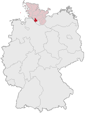
file:Lage des Kreises Pinneberg in Deutschland.png
Lage_des_Kreises_Pinneberg_in_Deutschland.png (176 × 234 pixel, file ke size: 4 KB, MIME type: image/png)
File ke itihaas
File ke dekhe khatir, jaise uu time dekhe me lagat rahaa, date/time pe click karo.
| Din/Time | Chhota chapa | Lambai aur chaurai | Sadasya | Tiprrin | |
|---|---|---|---|---|---|
| abhi waala | 12:21, 5 Aprel 2007 |  | 176 × 234 (4 KB) | Ditschi | transparent |
| 09:19, 3 Maach 2006 |  | 176 × 234 (4 KB) | Rauenstein | Karte erstellt auf der Grundlage der opengeodb.de-Umrisse - GNU-FDL Geograv 00:54, 31. Dez 2004 {{Bild-GFDL}} Category:Maps of Germany |
File ke kaise kaam me lawa gais hae
Niche ke panna kaam me laae hai ii file ke:
Global file usage
Ii aur duusra wiki ii file ke use kare hai:
- ace.wikipedia.org pe upyog
- am.wikipedia.org pe upyog
- ang.wikipedia.org pe upyog
- arc.wikipedia.org pe upyog
- av.wikipedia.org pe upyog
- ay.wikipedia.org pe upyog
- bcl.wikipedia.org pe upyog
- bi.wikipedia.org pe upyog
- bm.wikipedia.org pe upyog
- bpy.wikipedia.org pe upyog
- bxr.wikipedia.org pe upyog
- cbk-zam.wikipedia.org pe upyog
- ceb.wikipedia.org pe upyog
- ch.wikipedia.org pe upyog
- cr.wikipedia.org pe upyog
- cs.wikipedia.org pe upyog
- cu.wikipedia.org pe upyog
- cv.wikipedia.org pe upyog
- cy.wikipedia.org pe upyog
- dsb.wikipedia.org pe upyog
- dv.wikipedia.org pe upyog
- dz.wikipedia.org pe upyog
- eml.wikipedia.org pe upyog
- eo.wikipedia.org pe upyog
- es.wikipedia.org pe upyog
- ext.wikipedia.org pe upyog
- ff.wikipedia.org pe upyog
- fiu-vro.wikipedia.org pe upyog
- fj.wikipedia.org pe upyog
- fo.wikipedia.org pe upyog
- frp.wikipedia.org pe upyog
- frr.wikipedia.org pe upyog
- fr.wikipedia.org pe upyog
- fur.wikipedia.org pe upyog
- fy.wikipedia.org pe upyog
- gag.wikipedia.org pe upyog
- gn.wikipedia.org pe upyog
- got.wikipedia.org pe upyog
- hak.wikipedia.org pe upyog
- haw.wikipedia.org pe upyog
- hi.wikipedia.org pe upyog
- hr.wikipedia.org pe upyog
- ht.wikipedia.org pe upyog
- hy.wikipedia.org pe upyog
- id.wikipedia.org pe upyog
- ie.wikipedia.org pe upyog
- incubator.wikimedia.org pe upyog
Ii file ke more global usage kedekho.

