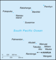
file:Cook Islands-CIA WFB Map.png
Cook_Islands-CIA_WFB_Map.png (325 × 350 pixel, file ke size: 5 KB, MIME type: image/png)
File ke itihaas
File ke dekhe khatir, jaise uu time dekhe me lagat rahaa, date/time pe click karo.
| Din/Time | Chhota chapa | Lambai aur chaurai | Sadasya | Tiprrin | |
|---|---|---|---|---|---|
| abhi waala | 23:25, 9 Saptambar 2010 |  | 325 × 350 (5 KB) | Ras67 | cropped and squeezed |
| 09:13, 27 Maach 2005 |  | 330 × 355 (5 KB) | Wolfman~commonswiki | {{CIA-map}} |
File ke kaise kaam me lawa gais hae
Niche ke panna kaam me laae hai ii file ke:
Global file usage
Ii aur duusra wiki ii file ke use kare hai:
- af.wikipedia.org pe upyog
- ar.wikipedia.org pe upyog
- avk.wikipedia.org pe upyog
- be-tarask.wikipedia.org pe upyog
- bg.wikipedia.org pe upyog
- cs.wikipedia.org pe upyog
- en.wikipedia.org pe upyog
- en.wikisource.org pe upyog
- eo.wikipedia.org pe upyog
- es.wikipedia.org pe upyog
- hu.wikipedia.org pe upyog
- id.wikipedia.org pe upyog
- ja.wikipedia.org pe upyog
- ko.wikipedia.org pe upyog
- lt.wikipedia.org pe upyog
- mr.wikipedia.org pe upyog
- mzn.wikipedia.org pe upyog
- pl.wikipedia.org pe upyog
- pt.wikivoyage.org pe upyog
- ru.wikipedia.org pe upyog
- shi.wikipedia.org pe upyog
- simple.wikipedia.org pe upyog
- sk.wikipedia.org pe upyog
- sw.wikipedia.org pe upyog
- tr.wiktionary.org pe upyog
- www.wikidata.org pe upyog
- zh-min-nan.wikipedia.org pe upyog


